SAR Oil Spill Detection
Oil Spill Detection using SAR Imagery
Introduction
This solution is based on an AI model designed for semantic segmentation of SAR remote sensing data. The model processes synthetic aperture radar (SAR) imagery to detect and segment oil spills in marine environments. The advantage of using SAR imagery lies in its ability to penetrate clouds and operate in low-light conditions, making it ideal for monitoring oil spills regardless of weather conditions.
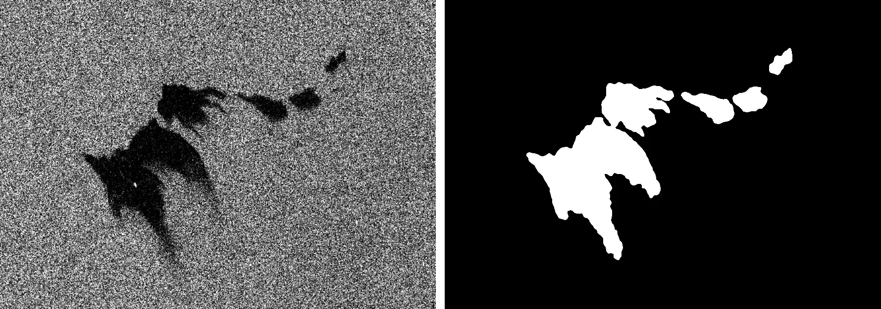 In figure: Example of the model’s prediction. On the left, a SAR image of a marine area, and on the right, the model’s prediction of the oil spill area (in white).
Key Features
- SAR Oil Spill Detection: Utilizes the unique properties of SAR imagery to differentiate oil from water with high accuracy, even in cloudy or in low-light conditions.
Technologies Used
- Remote Sensing Imagery: Synthetic aperture radar (SAR) images, which provide high-resolution data for surface characterization.
- Computer Vision: A U-Net architecture designed for semantic segmentation, employing a ConvNeXt backbone. Paper
Use Cases
This solution is valuable for environmental monitoring and emergency response in marine settings. For example, in case of an oil spill, the model can quickly identify and delineate the affected areas, enabling rapid response efforts.
Live Demo
Explore the practical results of our AI solution through this interactive demo. The application allows you to upload your own SAR images or use a sample image to visualize the model’s predictions.
Try it out
Try out the solution in real time on Hugging Face Spaces:
Integration
The pre-trained oil spill segmentation model is available for download via our Hugging Face repository. You can integrate it into your workflows to run inference on SAR images for automated oil spill detection.