Hyperspectral Oil Spill Detection
Oil Spill Semantic Segmentation Model
Introduction
This solution is based on an AI model designed for semantic segmentation of hyperspectral remote sensing data. The model processes high-dimensional imagery captured by the AVIRIS sensor, consisting of 224 spectral bands, to distinguish between water and oil spill regions.
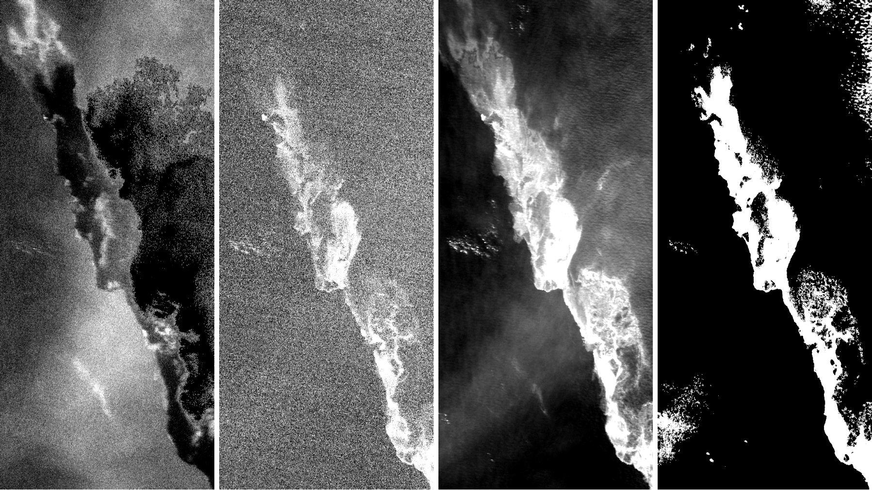 In figure: Example of the model’s prediction. From left to right: three AVIRIS bands (1, 119, 201), and the model’s prediction of the oil spill area (in white).
Key Features
- Hyperspectral Oil Spill Detection: Utilizes the full spectral range of AVIRIS imagery to differentiate oil from water with high accuracy, even in complex or low-contrast conditions.
Technologies Used
- Remote Sensing Imagery: Hyperspectral images from the AVIRIS sensor, offering 224 spectral bands for detailed surface characterization.
- Computer Vision: A custom convolutional neural network designed for hyperspectral segmentation, consisting of the following layers:
- 1×1 convolution, 32 filters without bias
- Group normalization
- ReLU activation function
- 3×3 convolution, 32 filters
- Group normalization
- ReLU activation function
- 3×3 convolution, 32 filters
- Group normalization
- ReLU activation function
- 1×1 convolution, 1 filter
Use Cases
This solution is valuable for environmental monitoring and emergency response in marine settings. For example, in the event of an oil spill, the model can process hyperspectral imagery to automatically detect and map the extent of contamination. This enables authorities and response teams to quickly assess the affected area, prioritize cleanup efforts, and monitor the spread over time.
Live Demo
Explore the practical results of our AI solution through this interactive demo. The application displays an example of a hyperspectral image capturing a sea oil spill, along with the corresponding ground truth segmentation and the model’s predicted output. This allows users to visually assess the model’s performance in detecting and segmenting oil-contaminated areas from water.
Try it out
Try out the solution in real time on Hugging Face Spaces: