Cropland Segmentation
Cropland Semantic Segmentation Model
Introduction
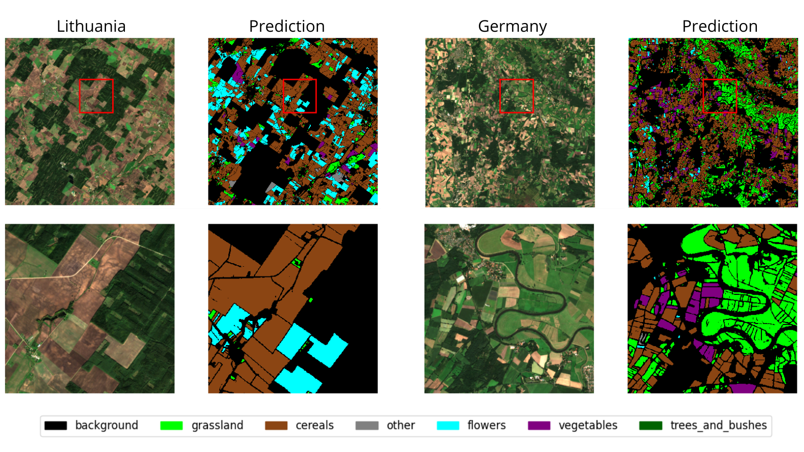
The presented solution is based on an AI model for semantic segmentation of cropland using satellite data. The model processes multi-temporal Sentinel-2 imagery (10 bands over 6 months) to solve the problem of identifying different crop types automatically and accurately. The model outputs a single segmentation map categorizing areas into six distinct crop classes, offering a significant impact by enabling scalable, cost-effective monitoring and analysis of agricultural land use across Europe.
Key Features
- Automated Cropland Monitoring: Enables efficient tracking and verification of crop types over vast agricultural areas throughout the growing season.
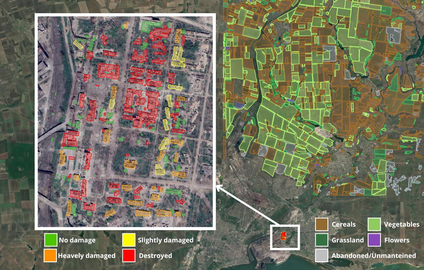
- Damage Assessment Support: Facilitates the analysis of crop status and potential losses by comparing land cover maps generated before and after adverse events (e.g., floods, droughts, pests).
Technologies Used
- Remote Sensing Imagery: Multi-temporal Sentinel-2 Images Data Catalog
- Computer Vision: U-Net with Temporal Attention Encoder Paper
Use Cases
The value of this automated approach was demonstrated in the AIDA project, aimed at supporting disaster management. In crisis situations (conflict or natural disasters), the model processed satellite time-series data to automatically map crop types. This provided essential baseline information for identifying agricultural anomalies and assessing damage after an impacting event.
Live Demo
Explore the practical results of our AI solution via the live demo. This interactive feature displays the crop classification maps produced by the model, demonstrating its performance on real Sentinel-2 data from diverse European areas and multiple years.
Try it out
Try out the solution in real time on Hugging Face Spaces:
Integration
You can integrate our solution in your own processes using the pre-trained crop segmentation model. The necessary model weights, containing the learned parameters, are publicly available for download directly from our Hugging Face repository.
By accessing these weights, users can deploy the trained model for inference on compatible Sentinel-2 time series data, enabling automated crop mapping within their own systems.